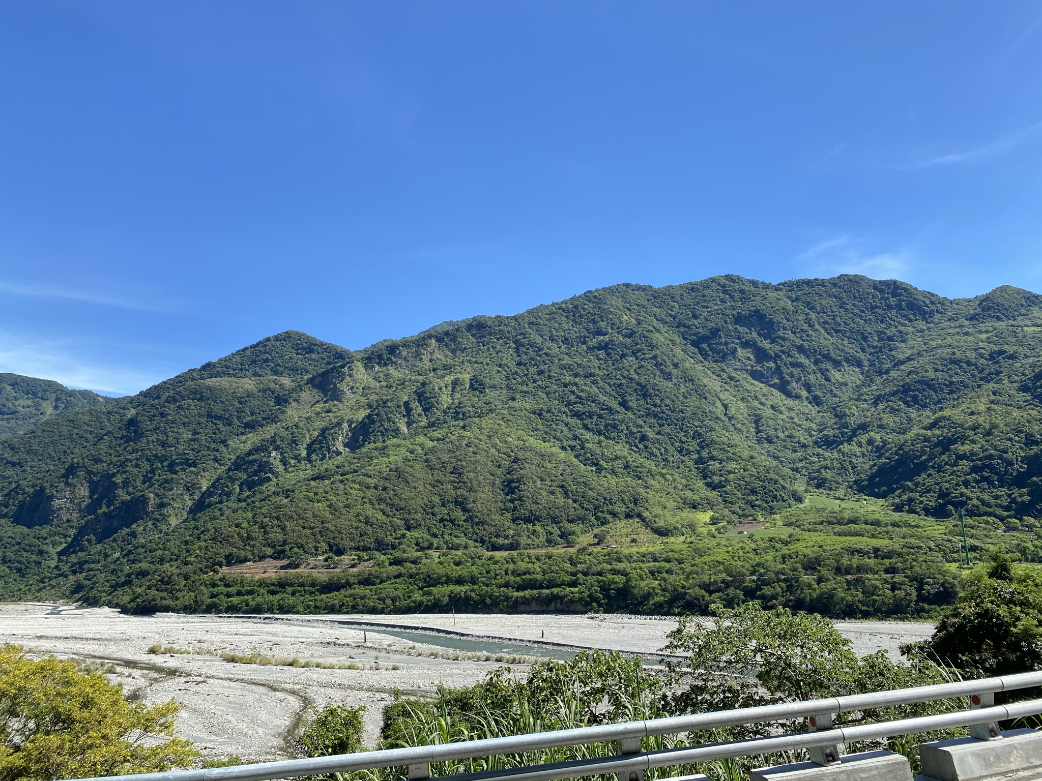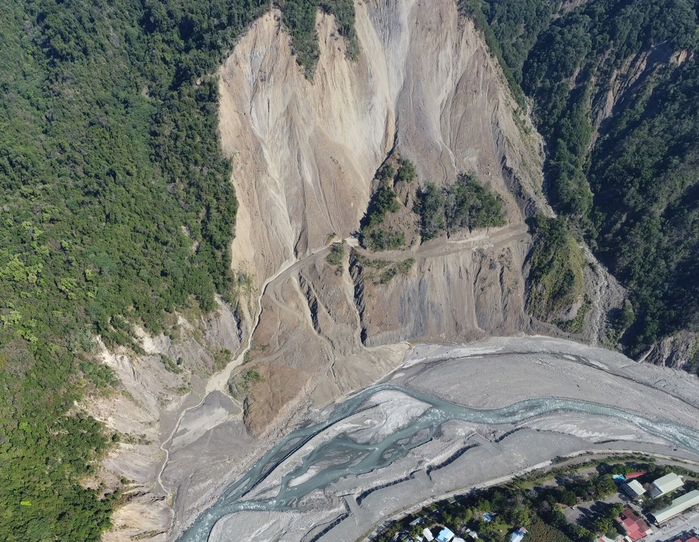
Airborne LiDAR Mapping (2005–2011)
Airborne LiDAR Mapping for Active Tectonics and Tectonic Geomorphology (2005–2011)
Project Director and Principal Investigator: Yu-Chang Chan
Commissioned and funded by the Central Geological Survey, Ministry of Economic Affairs, Taiwan
Lead research institution: Institute of Earth Sciences, Academia Sinica
Collaborating institutions: Industrial Technology Research Institute and Chung Hsing Surveying Co., Ltd.
English Introduction
From 2005 to 2011, a multidisciplinary research team led by Yu-Chang Chan of the Institute of Earth Sciences, Academia Sinica, conducted a seven-year program applying airborne LiDAR to tectonic geomorphology, active-structure mapping, and geological-hazard investigations. The work was commissioned and supported by the Central Geological Survey, Ministry of Economic Affairs, Taiwan—now the Geological Survey and Mining Management Agency—and was documented in seven annual open-file reports.
The program brought together expertise in structural geology, tectonic geomorphology, active tectonics, remote sensing, surveying, digital-terrain processing, and field geology. Major participating institutions included the Institute of Earth Sciences, Academia Sinica, the Industrial Technology Research Institute, and Chung Hsing Surveying Co., Ltd. The Central Geological Survey provided the institutional framework, project coordination, and support for incorporating the results into Taiwan’s geological investigation and hazard-assessment programs.
Researchers and technical personnel participating during different years included Jin-King Liu, Wei-Cheng Hsu, Ding-Yao Cheng, Kuo-Jen Chang, Rou-Fei Chen, Wen-Shan Chen, Jian-Cheng Lee, Jyr-Ching Hu, and Yu-Chung Hsieh, together with additional researchers, assistants, field personnel, LiDAR specialists, surveyors, pilots, and data-processing teams. Their collective contributions encompassed research design, geological and geomorphic interpretation, field verification, airborne surveying, ground control, point-cloud processing, digital elevation model production, and preparation of the annual reports. Because the composition of the team changed during the seven-year program, this list recognizes principal participants but is not intended as a complete record of everyone who contributed.
Phase I: LiDAR Mapping and Tectonic Geomorphology in the Taipei Metropolitan Area (2005–2007)
The first three-year phase focused on acquiring high-resolution airborne LiDAR data and applying the resulting digital terrain models to tectonic-geomorphic and geological-hazard investigations in the Taipei metropolitan area. The research was conducted by the team led by Yu-Chang Chan, with contributions from specialists at the Institute of Earth Sciences, Academia Sinica, the Industrial Technology Research Institute, and Chung Hsing Surveying Co., Ltd., in collaboration with the Central Geological Survey. The scientific team contributed expertise in active tectonics, structural geology, tectonic geomorphology, remote sensing, and field investigation, while the surveying and technical teams were responsible for flight planning, airborne data acquisition, positioning, point-cloud processing, and digital terrain model production.
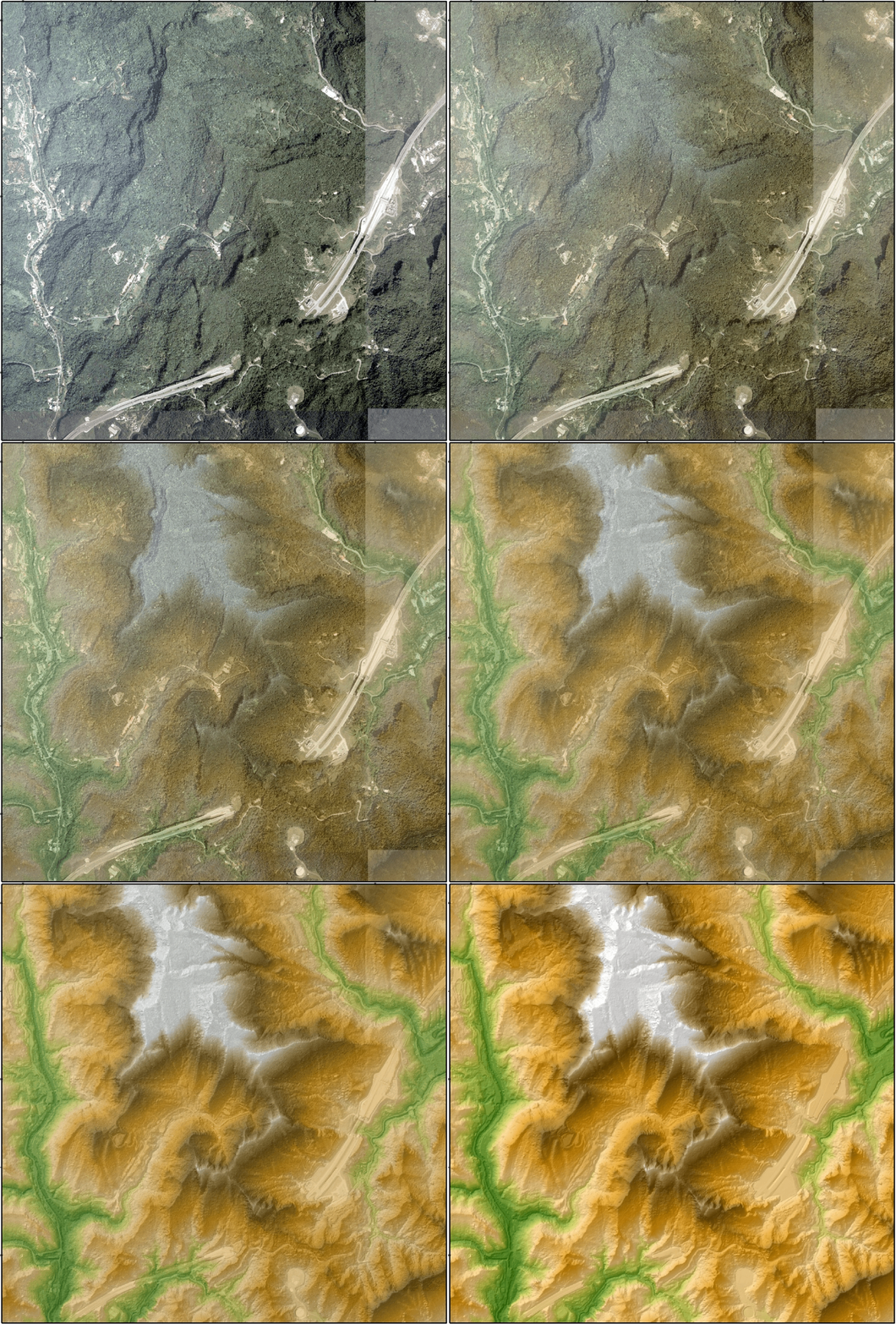
The Taipei region presented a particularly demanding setting because its active structures are partly obscured by dense vegetation, urban development, sedimentary basins, and volcanic terrain. By filtering vegetation and buildings from the LiDAR point clouds, the project produced high-resolution bare-earth models that revealed subtle fault scarps, displaced terraces, drainage anomalies, abandoned channels, basin margins, and landslide-related features. These observations were integrated with existing geological maps, aerial photographs, geomorphic analyses, and targeted field investigations.
This phase established an effective workflow connecting airborne surveying, digital-terrain processing, three-dimensional visualization, geological interpretation, and field verification. Its achievements resulted from sustained collaboration among earth scientists, remote-sensing researchers, professional surveyors, technical personnel, and the Central Geological Survey.
Phase II: LiDAR Analysis of Geological Structures and Active Tectonics (2008–2011)
The second four-year phase continued under the leadership of Yu-Chang Chan and the Institute of Earth Sciences, Academia Sinica, within the Central Geological Survey’s second-phase program for investigating and monitoring special geological hazards in the greater Taipei region. The project consolidated and extended the methods established during the first phase, placing greater emphasis on the systematic geological interpretation of LiDAR-derived terrain.
This phase refined procedures for constructing and visualizing bare-earth digital elevation models, recognizing geomorphic and geological lineaments, tracing possible structural boundaries, and comparing topographic evidence with field geology and other spatial datasets. These efforts depended not only on geological interpretation but also on the contributions of technical teams responsible for LiDAR acquisition, survey control, data classification, quality assessment, terrain-model production, and database management.
The enhanced terrain resolution helped identify geological and geomorphic relationships that were inconspicuous or imprecisely located on earlier maps. It also improved the ability to distinguish tectonic deformation from landsliding, differential erosion, drainage development, volcanic landforms, and human modification.
Overall Contributions and Significance
The seven-year program was a collaborative scientific, institutional, and technical undertaking. Yu-Chang Chan provided the overall scientific leadership and project direction, while researchers from several fields contributed geological interpretation, field observations, remote-sensing analyses, and methodological development. The airborne-surveying and data-processing teams provided the essential high-quality measurements and terrain products on which the geological analyses were based. The Central Geological Survey commissioned, supported, and published the work, enabling the results to contribute to Taiwan’s broader programs in geological investigation and hazard assessment.
Together, the two phases helped establish airborne LiDAR as a practical research and mapping tool in Taiwan. They also provided an early foundation for subsequent applications in active-fault mapping, landslide analysis, multitemporal topographic change detection, landscape-evolution studies, and high-resolution three-dimensional geological mapping.
Open-File Reports (CGS)
Airborne LiDAR Mapping Project for Active Tectonics and Tectonic Geomorphology (2005–2011)
Seven annual Open-File Reports published by the Central Geological Survey, Taiwan.
Chan, Y.-C., et al. (2011). Acquisition of High-Resolution Digital Elevation Model Using Airborne LiDAR Technique and Its Application to Active Tectonics (4/4). Open-File Report, 172 pp. Central Geological Survey, Taiwan. (In Chinese w/ English Abstract) Report Link ↗
Chan, Y.-C., et al. (2010). Acquisition of High-Resolution Digital Elevation Model Using Airborne LiDAR Technique and Its Application to Active Tectonics (3/4). Open-File Report, 169 pp. Central Geological Survey, Taiwan. (In Chinese w/ English Abstract) Report Link ↗
Chan, Y.-C., et al. (2009). Acquisition of High-Resolution Digital Elevation Model Using Airborne LiDAR Technique and Its Application to Active Tectonics (2/4). Open-File Report, 166 pp. Central Geological Survey, Taiwan. (In Chinese w/ English Abstract) Report Link ↗
Chan, Y.-C., et al. (2008). Acquisition of High-Resolution Digital Elevation Model Using Airborne LiDAR Technique and Its Application to Active Tectonics (1/4). Open-File Report, 157 pp. Central Geological Survey, Taiwan. (In Chinese w/ English Abstract) Report Link ↗
Chan, Y.-C., et al. (2007). Acquisition of High-Resolution Digital Elevation Model Using Airborne LiDAR Technique and Its Application to Tectonic Geomorphology in the Taipei Metropolitan Area (3/3). Open-File Report, 150 pp. Central Geological Survey, Taiwan. (In Chinese w/ English Abstract) Report Link ↗
Chan, Y.-C., et al. (2006). Acquisition of High-Resolution Digital Elevation Model Using Airborne LiDAR Technique and Its Application to Tectonic Geomorphology in the Taipei Metropolitan Area (2/3). Open-File Report, 188 pp. Central Geological Survey, Taiwan. (In Chinese w/ English Abstract) Report Link ↗
Chan, Y.-C., et al. (2005). Acquisition of High-Resolution Digital Elevation Model Using Airborne LiDAR Technique and Its Application to Tectonic Geomorphology in the Taipei Metropolitan Area (1/3). Open-File Report, 143 pp. Central Geological Survey, Taiwan. (In Chinese w/ English Abstract) Report Link ↗
空載光達於活動構造與構造地形之測繪應用(2005–2011)
計畫主持人:詹瑜璋
委託及經費支持:經濟部中央地質調查所
主要執行機構:中央研究院地球科學研究所
合作機構:財團法人工業技術研究院、中興測量有限公司
中文簡介
2005至2011年間,由中央研究院地球科學研究所詹瑜璋帶領的跨領域研究團隊,執行一項為期七年的空載光達研究計畫,將此項技術應用於構造地形、活動構造測繪及地質災害調查。計畫由經濟部中央地質調查所委託並提供經費支持,共完成七冊年度研究報告。中央地質調查所現已改制為經濟部地質調查及礦業管理中心。
本計畫整合構造地質、構造地形、活動構造、遙測、測量、數值地形處理及野外地質調查等專業。主要參與機構包括中央研究院地球科學研究所、財團法人工業技術研究院及中興測量有限公司。中央地質調查所提供計畫執行的整體架構與協調,並支持研究成果納入臺灣地質調查及地質災害評估工作。
不同年度參與計畫的研究與技術人員包括劉進金、徐偉城、鄭鼎耀、張國楨、陳柔妃、陳文山、李建成、胡植慶及謝有忠,另有多位研究人員、研究助理、野外工作人員、光達技術人員、測量人員、飛航人員及資料處理團隊共同參與。團隊的工作涵蓋研究規劃、地質與地形判釋、野外查核、空載測量、地面控制、點雲處理、數值高程模型產製及年度報告編撰。由於七年間的團隊組成有所變動,上述名單主要列出計畫的重要參與人員,並非所有貢獻者的完整名冊。
第一階段:臺北都會區光達測繪與構造地形研究(2005–2007)
第一階段為期三年,主要取得臺北都會區的高解析度空載光達資料,並將所產製的數值地形模型應用於構造地形及地質災害調查。本階段由詹瑜璋帶領研究團隊執行,參與者包括中央研究院地球科學研究所、財團法人工業技術研究院及中興測量有限公司的專業人員,並與中央地質調查所密切合作。科學研究團隊提供活動構造、構造地質、構造地形、遙測及野外調查等方面的專業;測量與技術團隊則負責飛航規劃、空載資料取得、定位測量、點雲處理及數值地形模型產製。
大臺北地區的地質與地形環境相當複雜,活動構造的地表表現部分受到茂密植被、都市開發、沉積盆地及火山地形的影響而不易辨識。透過光達點雲資料的分類與過濾,研究團隊得以移除植被與建物的影響,產製高解析度裸露地表模型,進而呈現細微的斷層崖、變形河階、異常水系、廢棄河道、盆地邊界及山崩相關地形。這些觀察結果進一步與既有地質圖、航空照片、地形分析及重點野外調查相互整合。
本階段建立了一套結合空載測量、數值地形處理、三維視覺化、地質判釋及野外驗證的有效工作流程。相關成果來自地球科學研究人員、遙測研究人員、專業測量人員、技術團隊及中央地質調查所之間的長期合作。
第二階段:光達地形之地質構造與活動構造分析(2008–2011)
第二階段為期四年,由詹瑜璋及中央研究院地球科學研究所持續負責執行,並納入中央地質調查所「大臺北地區特殊地質災害調查與監測第二期」的計畫架構。本階段整合並延伸第一階段所建立的方法,更加著重於光達地形的系統性地質判釋。
本階段進一步改進裸露地表數值高程模型的建置與視覺化方法,並用於辨識地形及地質線形、追蹤可能的地質構造邊界,以及比較數值地形、野外地質與其他空間資料所提供的證據。這些工作不僅依賴地質判釋,也有賴技術團隊在光達資料取得、測量控制、資料分類、品質評估、數值地形模型產製及資料庫管理等方面的投入。
高解析度地形資料有助於辨識過去地圖上不明顯或位置不夠精確的地質與地形關係,也提升了區分構造變形、山崩、差異侵蝕、水系發育、火山地形及人為改造等不同地形作用的能力。
整體貢獻與意義
這項為期七年的計畫是一項結合科學研究、機構合作與專業技術的團隊工作。詹瑜璋負責整體科學規劃與計畫主持,不同領域的研究人員則共同投入地質判釋、野外觀察、遙測分析及方法發展。空載測量與資料處理團隊提供了地質分析所需的高品質測量資料與數值地形成果。中央地質調查所負責計畫的委託、經費支持及成果出版,使研究成果得以納入臺灣更廣泛的地質調查與地質災害評估工作。
兩個階段的研究共同促進空載光達成為臺灣地質研究與測繪的實用工具,並為後續活動斷層測繪、山崩分析、多時期地形變遷偵測、地貌演育研究及高解析度三維地質製圖奠定早期基礎。
研究報告(中央地質調查所)
空載光達於活動構造與構造地形之測繪應用(2005–2011)
本計畫共完成七冊年度研究報告,由經濟部中央地質調查所出版。
詹瑜璋等(2011)。《大臺北地區特殊地質災害調查與監測第二期——空載雷射掃描數值地形地質構造分析(4/4)》。中央地質調查所研究報告,共172頁。報告連結 ↗
詹瑜璋等(2010)。《大臺北地區特殊地質災害調查與監測第二期——空載雷射掃描數值地形地質構造分析(3/4)》。中央地質調查所研究報告,共169頁。報告連結 ↗
詹瑜璋等(2009)。《大臺北地區特殊地質災害調查與監測第二期——空載雷射掃描數值地形地質構造分析(2/4)》。中央地質調查所研究報告,共166頁。報告連結 ↗
詹瑜璋等(2008)。《大臺北地區特殊地質災害調查與監測第二期——空載雷射掃描數值地形地質構造分析(1/4)》。中央地質調查所研究報告,共157頁。報告連結 ↗
詹瑜璋等(2007)。《大臺北地區特殊地質災害調查與監測——高精度空載雷射掃描(LiDAR)地形測製與構造地形分析(3/3)》。中央地質調查所研究報告,共150頁。報告連結 ↗
詹瑜璋等(2006)。《大臺北地區特殊地質災害調查與監測——高精度空載雷射掃描(LiDAR)地形測製與構造地形分析(2/3)》。中央地質調查所研究報告,共188頁。報告連結 ↗
詹瑜璋等(2005)。《大臺北地區特殊地質災害調查與監測——高精度空載雷射掃描(LiDAR)地形測製與構造地形分析(1/3)》。中央地質調查所研究報告,共143頁。報告連結 ↗
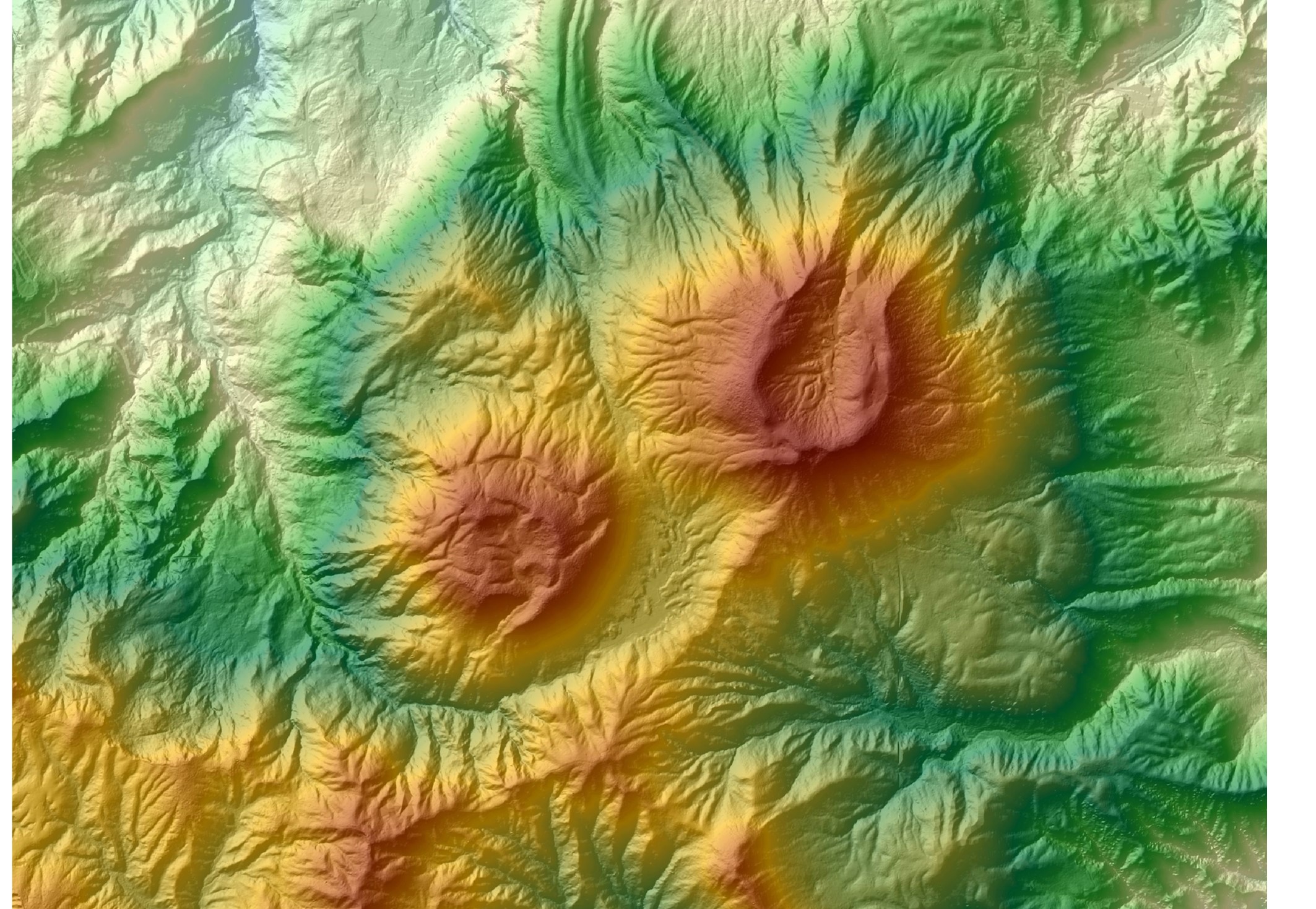
大屯火山群的首幅光達影像(攝製於 2005 年光達測繪計畫)