Mapping Two Decades of Thermal Change at Kueishantao from Space (2023)
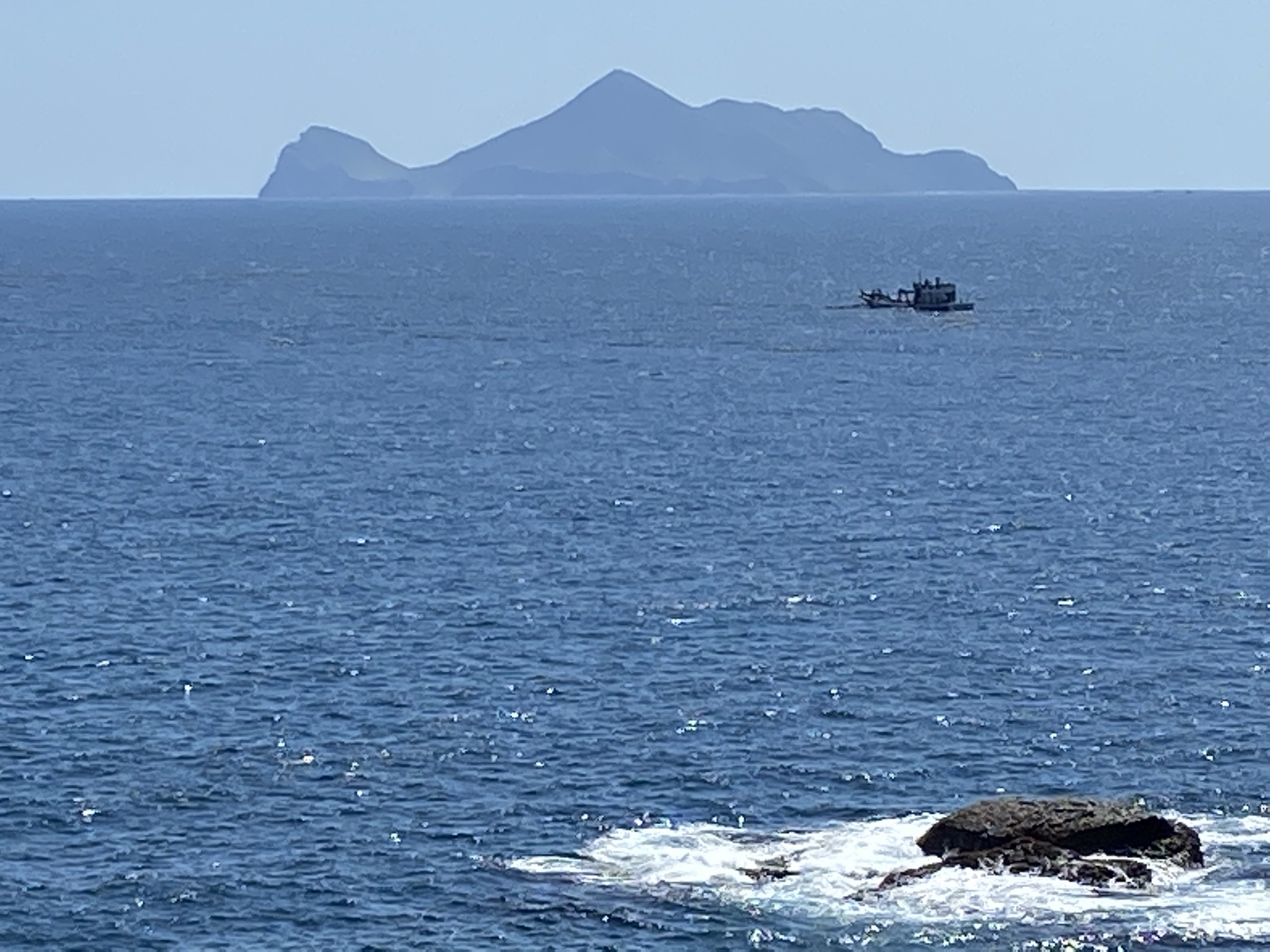
This research focuses on Kueishantao (also known as Turtle Island), an active and iconic volcanic island situated off the northeastern coast of Taiwan. The island is famous for its extreme underwater hot springs and active sulfur gas vents, making it a highly dynamic geological environment to study. We utilized thermal satellite imagery to measure and track the heat patterns on the surface of the island over an extended period. By carefully analyzing this satellite temperature data, we were able to map the specific thermal pattern of the volcano and observe exactly how its heat output fluctuated over time. The primary significance of this research is that it establishes a long-term thermal baseline for Kueishantao and the potential relations to the subsurface structures. Using satellites provides a continuous, and comprehensive view of its activity, helping us understand the volcano's hidden behaviors.
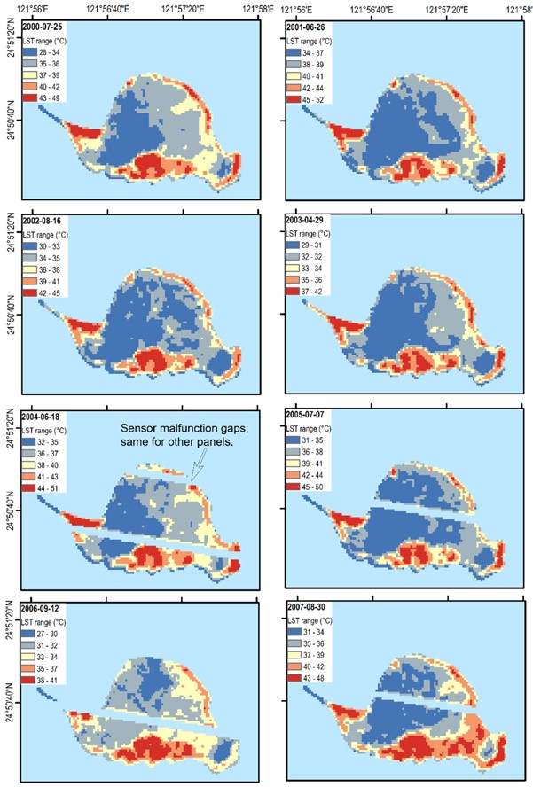
Kueishantao (KST) is an active volcanic island off the northeastern coast of Taiwan. Tectonically, it lies in the south of the Okinawa Trough and opposite to the Ilan plain, in which is the southwestern end of the trough. KST provides a convenient observation site for the subsurface geological and geothermal activity and mechanism at its proximity. Land surface temperature (LST) of volcanoes detected from satellite sensors reflects the thermal status of heat sources in the subsurface. LST thus is a key parameter to the understanding of the volcanic process and geothermal resources. This research utilizes the satellite-observed multi-temporal land surface temperature imagery in 1999–2022 on the Kueishantao volcano of Taiwan to explore its geothermal state. The U.S. NASA Earth-observing satellites onboard three thermal sensors (i.e., Landsat ETM+, Terra ASTER, and Aqua/Terra MODIS) derived time series of land surface temperature from 1999 are employed to define the past and current pattern of geothermal activity plus the future trend of the KST. The spatiotemporal LST distribution of KST volcano is explored and analyzed. The spatial LST distribution of the KST volcano indicates that LST anomaly areas are mainly located on the southeast island, which is well correlated with the possible magma reservoir location from previous geophysical and geological surveys. An increasing trend of two-decade LST time series is revealed from all three thermal sensors. The retrieved surface thermal pattern shows non-linear temperature variations that imply the non-steady-state nature of the subsurface thermal sources at this volcano. In summary, satellite LST observations facilitate the understanding on the subsurface magmatic processes of active volcanoes for further management of geothermal resources.
Citation:
Chan*, H.-P., & Chan, Y.-C. (2023). Thermal pattern at Kueishantao (KST) volcano of Taiwan from satellite-observed temperatures and its implication. Environmental Research Communications, 5, 075013. https://doi.org/10.1088/2515-7620/ace760.